If you’ve ever watched a drone hover smoothly above a grassy field, snap a sharp aerial photo of a mountain range, or navigate between trees without so much as a lurch, you’ve relied on a quiet, unassuming component working behind the scenes: the drone altimeter. As someone who’s spent the last five years supplying drone accessories to hobbyists, professional filmmakers, and agricultural operators, I can’t tell you how many times a customer has messaged me saying, “My drone crashed because it couldn’t tell how high it was.” That’s where the altimeter comes in—it’s not just a part; it’s the drone’s “sense of height,” and getting it right is non-negotiable for safe, reliable flight. Drone Accessories
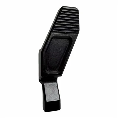
At its core, a drone altimeter is a sensor designed to measure the vertical distance between the drone and a reference point—most commonly ground level, sea level, or a takeoff point. Unlike the altimeter in a commercial airplane, which has to account for miles of altitude and extreme pressure changes, drone altimeters are built for the small, precise movements drones make: hovering at eye level for a real estate shot, maintaining 50 feet of clearance over a crop field, or ascending slowly to get a panorama. For a hobbyist flying a mini drone for fun, a faulty altimeter might mean a drone drifting into a tree; for a precision agriculture pilot, it could mean missing a section of crops that need spraying. That’s why when we source altimeters for our inventory, we prioritize models that balance accuracy, durability, and affordability—because our customers shouldn’t have to choose between safe flight and staying on budget.
To understand how a drone altimeter works, it helps to break down the most common types, since not all altimeters use the same technology. The three main types found in consumer and commercial drones are barometric, GPS, and ultrasonic, and many modern drones combine all three (a system called “sensor fusion”) to cover each other’s weaknesses. Let’s start with the most fundamental one: barometric altimeters. This is the workhorse of nearly every drone on the market, and it’s the one I recommend most often to customers who ask for a reliable, all-purpose option.
Barometric altimeters rely on the simple principle that atmospheric pressure decreases as altitude increases. The air around us is a layer of gases held in place by Earth’s gravity, so at higher elevations, there’s less air pressing down on any given surface. A barometric sensor in the altimeter has a tiny, sensitive pressure cell that measures this pressure in hectopascals (hPa) or millibars. When a drone takes off, the sensor reads the pressure at ground level as a baseline. Then, as the drone rises, it detects a drop in pressure, and a pre-programmed algorithm converts that pressure change into an altitude reading. For example, a standard formula is that pressure drops about 1 hPa for every 8.5 meters of altitude gain—so if the sensor reads 10 hPa lower than baseline, the drone is approximately 85 meters up.
But barometric altimeters aren’t perfect. The biggest issue is weather changes: if a cold front moves through mid-flight, atmospheric pressure can shift even if the drone isn’t moving vertically. That might make the altimeter think the drone is rising when it’s just experiencing a pressure change, leading it to lurch upward unexpectedly. I’ve had customers tell me their drones flew off course on windy days, and nine times out of 10, it’s because the barometric altimeter misread a pressure shift from wind or a weather system. That’s why most drones pair barometric altimeters with another sensor, usually GPS, to correct for these errors.
GPS altimeters are the next most common type, and they work by calculating altitude using signals from at least four GPS satellites orbiting Earth. Each satellite broadcasts a precise time and location, and the drone’s GPS receiver measures how long it takes for those signals to arrive. By triangulating the distance to multiple satellites, the receiver can determine its exact position on Earth, including its altitude above sea level. The beauty of GPS is that it doesn’t rely on atmospheric pressure—so it won’t be thrown off by weather changes, and it can track altitude over much larger ranges than a barometric sensor. For professional surveyors or filmmakers working in mountainous areas, GPS altitude is often the most reliable long-distance reference.
But GPS has its own flaws, especially for small drones. First, GPS accuracy is generally within 1 to 3 meters for consumer-grade receivers, which might be fine for a drone hovering at 100 feet, but not for a drone that needs to hold steady at 1 meter above the ground to capture close-up details. Second, GPS can’t penetrate enclosed spaces—if you’re flying a drone indoors, or in a canyon with tall walls blocking satellite signals, the GPS altimeter will lose its connection and stop working. That’s where ultrasonic altimeters come in, the third type most drones use.
Ultrasonic altimeters, sometimes called sonar altimeters, work like a bat’s echolocation. The sensor emits high-frequency sound waves (too high for humans to hear) and measures the time it takes for the sound to bounce off the ground and return to the drone. Since sound travels at a consistent speed in air (about 343 meters per second), the sensor can calculate the distance to the ground by dividing the time it takes for the echo to return by two. This technology is incredibly accurate for short distances—within a few centimeters—making it perfect for low-altitude flight, hovering, and taking off or landing. It’s also the only altimeter that works reliably indoors, since it doesn’t need satellite signals.
The downside of ultrasonic altimeters is that they only work at very low altitudes—usually up to 10 or 15 meters. Once a drone is higher than that, the sound waves spread out too much, and the echo becomes too weak to measure accurately. Wind can also mess with the sound waves, making it hard to get a consistent reading. That’s why the best drones use a system called sensor fusion, combining all three altimeter types (and often adding a second barometric sensor for extra accuracy) to make up for each other’s weaknesses. For example, when a drone takes off, it uses ultrasonic altimeter readings to hover at low altitude until its GPS lock is strong. Once it’s in flight, the barometric and GPS sensors work together to maintain altitude, correcting each other for pressure shifts or GPS signal errors. When landing, it switches back to ultrasonic to get a precise distance to the ground as it touches down.
As a drone accessories supplier, I’ve learned a lot about what customers need when it comes to altimeters. Hobbyists often don’t realize that the altimeter is one of the most critical components for safe flight, so they might skip checking it during pre-flight checks. Professional operators, on the other hand, know that a faulty altimeter can cost them thousands of dollars in equipment and missed deadlines. That’s why we stock a range of replacement altimeters for popular drone models, as well as calibration tools to help customers make sure their altimeters are reading correctly. We also sell altimeters for custom-built drones, since many people who build their own drones from scratch struggle to find reliable, affordable sensor packages.
Calibration is a big part of getting the most out of a drone altimeter, and it’s something I always advise customers to do before every flight, especially in new locations. For barometric altimeters, calibration means setting the baseline pressure at takeoff—most drones have a simple calibration function in their app that does this automatically, but you can also set it manually if you know the current atmospheric pressure from a nearby weather station. GPS altimeters calibrate themselves when they lock onto satellites, but it’s important to give them time to get a full lock (usually 10 to 15 seconds) before taking off. Ultrasonic altimeters just need a clear line of sight to the ground—if you’re taking off from a surface with a lot of uneven terrain or tall grass, the sound waves might bounce in multiple directions, leading to inaccurate readings, so it’s best to take off from a flat, open area when possible.
Another common question I get is: can I upgrade my drone’s altimeter? The short answer is yes, but it depends on the drone model. For many consumer drones, the altimeter is built into the flight controller, so you can’t replace it without replacing the whole flight controller. But for many mid-range and professional drones, as well as custom-built drones, you can swap out the altimeter for a higher-accuracy model. For example, we sell high-precision barometric altimeters with a accuracy of less than 0.5 meters, which is perfect for professional photographers who need their drones to hover exactly at the right height for a shot. We also sell waterproof altimeters for customers who fly drones in wet or dusty conditions, since dust and moisture can damage the sensitive pressure cells or ultrasonic sensors.
I’ve seen firsthand what happens when an altimeter fails. A few years ago, a customer reached out to me in a panic, saying their $2,000 drone had crashed into a power line because it misread its altitude. When I asked about their pre-flight checks, they said they’d skipped calibrating the altimeter because “it always works on its own.” That’s a mistake I try to teach every customer: the altimeter isn’t a set-it-and-forget-it part. It needs regular checks and calibration to make sure it’s giving the drone the right height data. Since that incident, that customer has become one of our repeat buyers, and they always remind new hobbyists to prioritize their altimeter during pre-flight.
At the end of the day, the drone altimeter is a perfect example of how small, unassuming technology makes drone flight possible. It’s not the camera that takes the stunning photos or the propellers that lift the drone into the air, but without the altimeter, the drone would be flying blind, drifting up, down, and sideways with no way to control its height. Whether you’re a hobbyist flying a mini drone for fun, a professional filmmaker capturing aerial footage, or an agricultural operator monitoring crop health, the altimeter is your drone’s most important tool for safe, reliable flight.
If you’re a drone operator looking for reliable altimeters, replacement parts, or calibration tools to keep your drone flying smoothly, we’d love to chat with you about your needs. We work with hobbyists, small businesses, and large operators, so no matter what kind of drone you’re flying, we can help you find the right accessories to keep your flights safe and successful. Feel free to reach out to us to discuss your requirements and learn more about our inventory.
Electronic Information Equipment Components References
Drone Altimeters: Types and Working Principles. Drone Life Magazine.
Barometric Pressure and Altitude Calculations. National Weather Service.
GPS Altitude Accuracy for Unmanned Aerial Systems. Journal of Unmanned Vehicle Systems.
Ultrasonic Sensors for Low-Altitude UAV Navigation. IEEE Transactions on Aerospace and Electronic Systems.
Dongguan Yixin Metal Products Co., Ltd.
With abundant experience, we are one of the most professional drone accessories manufacturers and suppliers in China. Please rest assured to wholesale advanced drone accessories made in China here from our factory. Good service and quality products are available.
Address: No.172, Daxing Road, Yangwu, Zhen, Dongguan City, Guangdong Province, China
E-mail: Chengxingfeng123@163.com
WebSite: https://www.zgdgyixin.com/
